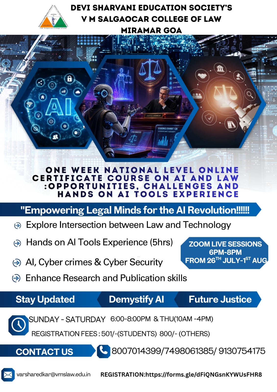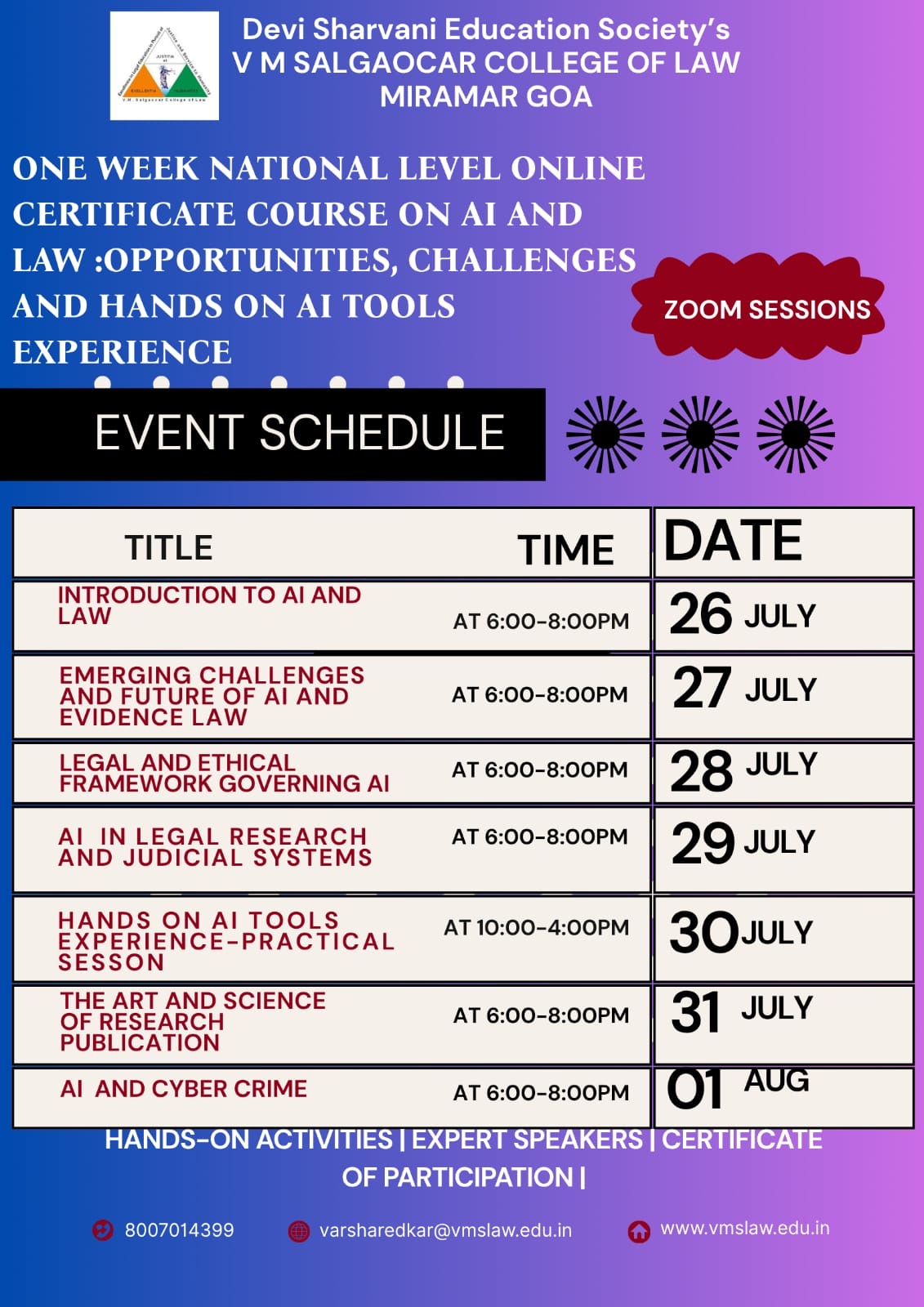
Ms. Sidhdhi Digambar Raul
Faculties Core Faculty Members

System Administrator
Ms. Sidhdhi Digambar Raul
Education:
MCA., Pune University, Pune
BCA., Goa University, Goa
System Admininstrator
Sidhdhi Digambar Raul is the System Administrator at V.M. Salgaocar College of Law.
Before being named System Administrator in November 2022, Sidhdhi has worked as a Senior Software Developer at ICAR – Central Coastal Agricultural Research Institute – Goa and was responsible to develop website for central government under Rashtriya Krishi Vikas Yojana (RKVY). She also headed 3 mega projects initiated by Central Government and played a key role in designing and developing user interfaces, testing, debugging, and training staff within eCommerce technologies. She has a Proven ability in optimizing web functionality that improves data retrieval and workflow efficiencies.
Sidhdhi pursued her MCA in Computer Engineering from Pune University and a Bachelor of Computer application degree from Goa University.
Professional Experience
Company Name: ICAR – Central Coastal Agriculture Research Institute
Projects Undertaken
Project 1 : Agri Goa Expert
- Agri Goa Expert was implemented with an aim for Development of comprehensive agriculture e-portal for Goa.
- It will help farmers to directly register any agricultural queries using Expert Consultation Form for which SMTP Mail Communication technique is being used.
- Queries registered by the farms are replied by scientist using admin panel which comprises of composing, receiving, transferring mail to other department and changing privacy settings.
Project 2 : Automatic Weather Station (AWS)
- 6 AWS (Automatic Weather Station) have been installed at 6 different Talukas of Goa which will monitor important weather variables continuously and send data via OTA platform to the server and the same data is also accessible on the website
Project 3 : Coastal Information System (CIS)
- Georeferencing a digital image or a scanned map and adding geographic information to the image so that GIS or mapping software can ‘place’ the image in its appropriate real world location.
- Digitizing by converting geographic features on a paper map into digital format. The x, y coordinates of point, line and polygon features are recorded and stored as the spatial data. The feature attributes are also recorded during the digitizing process.
- Collection and compilation of data on coastal agriculture and allied sectors.